CastOutlook
Read the water. Time the bite.
Fishing outlooks, best bite windows, nearby boat ramps, and practical access details — all in one trip-planning app.

Available now for iPhone.
Forecast the bite, find the water, and know where to launch
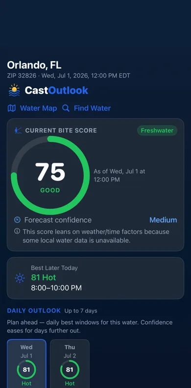
CastOutlook is an iPhone app that answers the three questions every trip starts with: when should I fish, which water should I choose, and how do I actually get on it. It turns local environmental conditions — weather, wind, barometric pressure, and daylight timing, plus tides, streamflow, and water temperature where available — into a straightforward Bite Score, a best window for today, and a 7-day outlook, then helps you pick a water and see the nearby ramps and access details that make the trip practical.
What you get
- Fishing Outlooks — a clear 0–100 Bite Score for your area or a selected water, built from public environmental data by transparent rules.
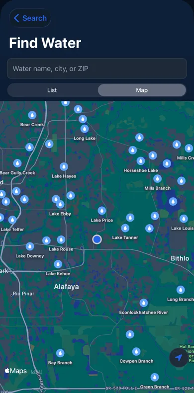
- Find Water — search waterbodies by name or browse the map to pick the water you actually want to fish.
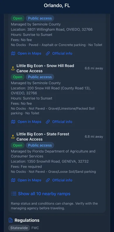
- Boat Ramps & Access — nearby public ramps with the practical details that decide a trip: distance, status, agency, hours, fees, parking, and facilities, when available.
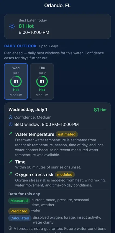
- Best Bite Windows — the strongest window today and a 7-day outlook, so you can plan around work, tide, and daylight.
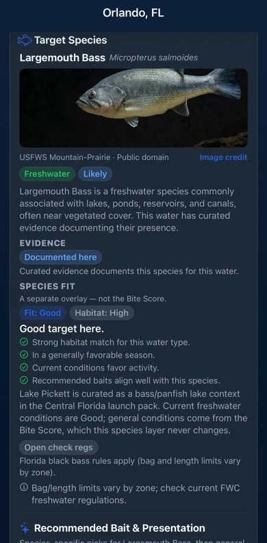
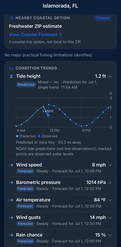
- Conditions, Water & Species — source-backed conditions and charts, tide or flow data where available, and species guidance for your target fish.
Free includes water search, species, ramps and access, plus 2 full fishing forecasts each day. CastOutlook Pro adds unlimited forecasts, unlimited Saved Waters, full history and detailed trends — $1.99/month or $14.99/year.
See CastOutlook in action
Real app screens — time the bite, pick a water, find the ramps, and plan with species-specific guidance.
Know where to launch
Picking the right water is only half the trip — you still have to get on it. When you select a water, CastOutlook shows the nearby public ramps and access points it has on file, with the practical details that decide whether a spot actually works for your boat, your kayak, or a walk-in.
Shown when available for the selected water:
- Nearby public ramps and access points
- Distance from your water
- Access status and whether it is public
- Managing agency
- Address and directions
- Operating hours
- Fees
- Boat-launch lanes and docks
- Parking and surface type
- Restrooms and other facilities
- Links to maps and official agency information
Ramp and access details are shown when available. Coverage varies by location. Verify current information with the managing agency before traveling.
Honest by design
- Forecasts are built by deterministic, transparent rules from public environmental data — the app shows where every number comes from.
- Weather is a forecast model for your surrounding area, not a measurement at the water; station readings are labeled with the nearby station and its distance; tide curves are predictions, shown apart from observed water levels.
- Missing data is shown as missing — never invented.
- A forecast is planning guidance, not a guarantee of a catch.
Coverage
CastOutlook is available in Florida, Georgia, Alabama, Tennessee, South Carolina, North Carolina, Virginia, West Virginia, Kentucky, Maryland, Delaware, Pennsylvania, New Jersey, New York, Connecticut, Rhode Island, Massachusetts, Vermont, New Hampshire, Maine, Ohio, Indiana, Illinois, Wisconsin, Michigan, Minnesota, Iowa, Missouri, Arkansas, and Mississippi — from Lake Erie and the Allegheny to the Chesapeake Bay, Delaware Bay, Kentucky Lake and the Gulf and Atlantic coasts. More coverage is planned as we expand.
- Available now